The Climate of Taiwan
Relevant Websites
- Centrual Weather Bureau
- Center for Space and Remote Sensing Research
- Da-qi-ke-xue-jiao-xue-yu-xue-xi-fu-zhu-zi-xun
- The Meteorological Research and Development Center at the Central WeatherBureau
- Global Change Research Center in NTU
- Sheng-ying-xian-xiang-yu-tai-wan-di-qu-qi-hou-zhi-xian-xiang
- 24-jie-qi-yu-qi-xiang-yan-yu24
- Hurricanes,Typhoons and Tropical Cyclones
Reference
- Chiang, Ping-jan, 1954: Tai-wan-qi-hou-zhi, Tai-wan-yan-jiu-cong-gan-di-26-zhong, Taipei, p. 220.
- Kuo, wen-shuo, 1978: Tai-wan-nong-ye-qi-hou-yan-jiu, Central Weather Bureau, pp. 1-266.
- Chen, Kuo-yen, 1980: Tai-wan-di-qu-nian-jiang-shui-liang-de-chang-qi-bian-dong, Shi-da-di-li-yan-jiu-bao-gao, Vol. 6, pp.37-44.
- Chen, Kuo-yen, 1984: Ke-ben-qi-hou-fen-lei-de-fang-fa-yu-jiao-xue, Zhong-deng-jiao-yu, Vol. 35-2, p.4-9.
- Chen, Kuo-yen, 1987: Tai-wan-de-ji-jie-fen-lei-shi-lun, Shi-da-di-li-yan-jiu-bao-gao, Vol. 13, pp.57-70.
- Heieh Chian-min, 1964: Taiwan Ilha Formosa, Butterworths, London, pp.44-73.
- Environmental Protection Administration Government of R.O.C. edited, 1996: Zhong-hua-min-guo-tai-wan-di-qu-huan-jing-zi-xun, Taipei, Environmental Protection Administration Government of R.O.C, pp. 11-15.
Climate
Taiwan is situated between the world's largest continent (Asia) and largest ocean (Pacific). The Tropic of Cancer (23.5° N) running across its middle section divides the island into two climates, the tropical monsoon climate in the south and subtropical monsoon climate in the north. High temperature and humidity, massive rainfall and tropical cyclones in summer characterize the climate of Taiwan. The latitude and topography, ocean currents and monsoons are the main contributing factors. According to Köppen's climate classification, the four climate types in Taiwan are a Monsoon and Trade-Wind Coastal Climate (Am) in the south, Mild, Humid Climate (Cfa) in the north, Wet-Dry Tropical Climate (Cwa) in the west, and Temperate Rainy Climate with Dry Winter (Cw) in mountain areas.
Temperature
Taiwan's annual average temperature is about 24 degrees Celsius in the south and 22°C in the north. In July, the warmest month, the island's temperature goes up to 27°C with the north slightly warmer than the south. In the winter, the coldest average temperature for the north is about 15°C in February while that for the south is around 19°C in January. Northern Taiwan thus experiences a greater range of temperature throughout the year than its southern counterpart.
The temperature in mountainous areas drops with increasing altitude. The annual temperature range is smaller in the mountains than in the plains but the daily range is greater.
Rainfall
The main stream of the northward-moving Kuroshio Current passes up the eastern coast of Taiwan, thus bringing in warm and moist air. Summer and winter monsoons also bring intermittent rainfall to Taiwan's hills and central mountains. As a result, more than 2,500 millimeters of rain fall every year. Huoshaoliao is the rainiest place in Taiwan, receiving 6,700 mm of rain a year. The coast of the northern Chianan plain and the Penghu archipelago are the driest spots, with less than 1,000 mm per year. Some characteristics of Taiwan's rainfall are as follows:
a. Spatial distribution of rain:
More rain falls in the mountains than in the plains, on the east coast than the west coast, and on the windward side of hills than the leeward (sheltered) side.b. Seasonal distribution of rain:
The north has rain all year round while the south is rainy in summer and dry in winter. In winter, when the northeastern monsoon system is active, the north is constantly visited by drizzle while the south remains dry. However, in summer when the southwestern monsoon comes in force, afternoon thunderstorms and typhoons carry heavy rain to central and southern Taiwan. This intensive and concentrated summer rainfall, which constitutes up to 80 percent of annual precipitation, often causes flooding and landslides.c. Variability of rainfall:
As northern Taiwan has more rainy days than the south, the variability of rainfall increases as we move toward the south.Wind
While typhoons only occasionally visit Taiwan in the summer and autumn, monsoons affect the island's climate year round. From October to April, in addition to the northeastern trade winds there are northeastern monsoons with their gusting winds and rapid changes in pressure. The winds are so strong that a windbreak forest has been planted on the northern coast to minimize damage. Under the influence of the Chinese mainland's high-pressure system, winds over the Taiwan Straits are even stronger, blowing across the Penghu archipelago at a speed of ten meters per second for about one-third of the year. From May to September the southwestern monsoon, a slow pressure-change system whose force is offset by northeastern trade winds, comes in with a lower wind speed.
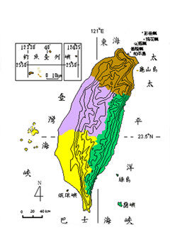
Typhoons visit the island from June to October, more frequently in August and September. On average 3.5 typhoons hit Taiwan every year, causing heavy rains and environmental damage. But mild typhoons bring timely rainfall for the forests and crops. Typhoons usually land in the southeastern part of Taiwan and move in a northwesterly direction. They follow basically seven routes, but those crossing northern Taiwan, the sea off the north coast or southern Taiwan, as well as those moving toward the west or northwest usually cause the most serious damage.
Sunshine
The number of hours of sunshine has an inverse relationship with the degree of cloudiness. That is, the accumulation of clouds shortens the day. Less sunshine is seen in the mountains than on the plains, and less on the east coast than the west. While rainy days prevent Keelung and Taipei from getting much sunshine, the southwestern city of Tainan enjoys 2,649 hours of sunshine a year, seven hours a day on average. The peak of Yu Shan, being above the clouds, is exposed to longer hours of sunshine. Lulin Shan has especially limited sunshine between summer and autumn because convective clouds are active during this season and blanket the mountain.
Figure 1-1-1 Main routes taken by typhoons which have hit Taiwan in the past 100 years(Source: Central Weather Bureau)