Geography of Taiwan: A summary
Relevant Websites
- Fa-xian-fu-er-mo-sha- di-li-pian
- Tai-wan-de-gu-shi
- Tai-wan-su-yan
- Tao-yuan-xian-li-jian-guo-guo-zhong-di-li-ke-jiao-xue-zi-yuan-zhong-xin
- Tai-wan-di-li-shen-du-zhi-lu
- Mei-li-de-tai-wan
- TheRepublic of China at a Glance
- Taiwan
- Moreabout Taiwan and Taipei!
Reference
- Agricultural Statistics of Republic of China, Councilof Agriculture, Executive Yuan.
- Wang, Ming-kuo and Chao-shen Hsieh, 1989:Tai-wan-tu-rang (Tai-wan-di-qu 1:250,000 tu-rang-shuo-ming-shu),National Chung Hsing University, p. 205.
- Shih, Tsai-tien, 1972: Taiwan-di-xing-qi-quan,Zhong-yang-yue-gan, Vol.4 - 3, pp. 173-180.
- Environmental Protection Administration Government ofR.O.C., 1990: Shui-zhi-bao-hu-ji-shui-zi-yuan-zhi-yong-xu-li-yong.
- Ho, Chun-sun, 1986: Tai-wan-di-zhi-gai-lun, CentralGeological Survey, p. 164.
- Lee,Shiun-feng,1983:Tai-wan-di-qu-zhi-zao-ye-qu-wei-bian-qian-de-ji-liang-yan-jiu,Tai-wan-yan-jiu-cong-gan, no. 118, p.176.
- Lin, Chao-chi, 1957: Tai-wan-di-xing,Tai-wan-sheng-wen-xian-wei-yuan-hui, p. 424.
- Lin, Chao-chi and Jui-tun Chou, 1978: Tai-wan-di-zhi,Maw Chang Book Co., p. 450.
- Lin, Man-hung, 1997:Cha-tang-zhang-nao-ye-yu-tai-wan-chi-she-hui-jing-
ji-bian-qian, Taipei, Linking Publishing Company. - Shih,Tien-fu, 1987:Qian-dai-zai-tai-han-ren-de-zu-ji-fen-bu-he-yuan-xiang-sheng-huo-fang-shi,Department of Geography - National Taiwan Normal University.
- Ma, Shih-yuen, 1999: Tai-wan-yong-xu-fa-zhan-de-gun-jing-yu-chu-lu,Tai-wan-she-hui-wen-ti-yan-jiu-yan-tao-hui, Institute of SociologyAcademia Sinica.
- Tsao,Yung-ho, 1981: Zao-qi-tai-wan-de-gai-fa-yu-jing-ying,Tai-wan-zao-qi-li-shi-yan-jiu, Taipei, Linking Publishing Company, pp.71-156.
- Liang,Chu-jung and Chang-yun Chou, 1978: Tai-wan-zhi-tu-rang,Shi-da-di-li-yan-jiu-bao-gao, Vol. 4, pp.1-44.
- Kuo,wen-shuo, 1978: Tai-wan-nong-ye-qi-hou-yan-jiu, Central Weather Bureau,pp. 1-266.
- Chen,Kuang-hua, 1982: Zhong-guo-de-jian-tong-yun-shu-fa-zhan,Zhong-yang-wen-wu-gong-ying-she, p. 472.
- Chen,Chi-nan, 1981, Tai-wan-de-chuan-tong-zhong-guo-she-hui, Taipei, AsianCulture Co..
- Chen,Chi-nan, 1987: Tai-wan-de-chuan-tong-zhong-guo-she-hui, Taipei, LinkingPublishing Company, pp. 157-158.
- Chen,Shao-hsin, 1979: Tai-wan-de-jia-ting-shi-xi-he-ju-luo-xing-tai,Tai-wan-de-ren-gou-bian-qian-yu-she-hui-bian-qian, Taipei, LinkingPublishing Company, pp. 443-487.
- Chen,Shao-hsin, 1979: Tai-wan-de-ren-gou-bian-qian-yu-she-hui-bian-qian,Taipei, Linking Publishing Company, p. 578.
- Cheng,Da-hsueh, 1991: Tai-wan-gai-fa-shi, Taipei, Zhongwen Book Co..
- Yang,Wan-chuan, 1982: Shui-wen-xue, Taipei, Department of Geography -National Taiwan Normal University.
- Yang,Ching-li, 1997: Tai-wan-di-qu-ren-gou-bian-qian-de-shen-ceng-wen-ti,Zheng-ce-yue-kan, Vol. 28, pp. 2-4.
- Tai-wan-yin-hang-jing-ji-yan-jiu-shi,1956: Tai-wan-kuang-ye-te-ji, Tai-wan-ji-kan, Vol. 8, NO. 3, pp.1-105.
- Liu,Tang-jui and Tung-hsin Lu, 1972, Zhi-wu-di-li-xue,Zhong-shan-ke-xue-da-ci-dian, Di-ba-ce-zhi-wu-xue, Taipei,Tai-wan-shang-wu-shu-ju, pp. 271-296.
- Chiang,Ping-jan, 1954: Tai-wan-qi-hou-zhi,Tai-wan-yan-jiu-cong-gan-di-26-zhong, Taipei, p. 220.
- Cheng,Sheng-hua, 1995: Tai-wan-ye-sheng-dong-zhi-wu-ji-bao-yu,Di-li-ke-bu-chong-jiao-cai(xia), Taipei, National Institute forCompilation and Translation, pp. 225-254.
- TourismBureau, 1992: Tai-wan-di-qu-guan-guang-you-qi-xi-tong-kai-fa-ji-hua,Taipei, Tourism Bureau of Ministry of Communication, p. 630.
A. Location
Located in the southeastern corner of Eurasia, Taiwan sits in the middle of the Western Pacific festoon of islands. It faces the East China Sea to the north (600 km from the Ryukyu archipelago), the Bashi Channel to the south (350 km from the Philippines), the Taiwan Strait to the west (averaging 200 km from the Chinese mainland), and the Pacific Ocean to the east. Situated at the western rim of the Pacific Basin, the island plays an important role as an East Asian crossroad.
B. Area
The greater area of Taiwan includes the island of Taiwan, the 64 islets of the Penghu archipelago, and more than 20 other outlying islets. Taiwan also has jurisdiction over the Kinmen archipelago and Matsu archipelago of Fukien Province and the Spratly Islands of the South China Sea.
Despite having a total area of only about 36,000 sq. km, Taiwan spreads across 5°16' 27" in longitude and 4°11'5" in latitude. Its extreme western edge (Penghu) lies at 119°18'3"E, eastern edge (I-lan) at 124°34'30"E, northern (I-lan) at 25°56'30"N and southern (Hengchun) at 21°45'25"N.
C. Physical Geography
(a) Geology
The island of Taiwan is one part of the southeastern edge of the Eurasian plate. At the end of the Tertiary period (12 million years ago), the plate where today's Taiwan Strait is located collapsed, thus making Taiwan a continental island which shared its fauna and flora with Eurasia.
(b) Climate
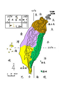
The Tropic of Cancer (23.5° N) running across Taiwan's middle section divides the island into two climactic zones, tropical in the south and subtropical in the north. The island's average annual temperature is about 24 degrees Celsius in the south and 22°C in the north. The main stream of the northward-moving Kuroshio Current passes up the eastern coast of Taiwan, thus bringing in warm and moist air. Summer and winter monsoons also bring intermittent rainfall to Taiwan's hills and central mountains. As a result, more than 2,500 millimeters of rain fall every year.
(c) Topography and Pedology
The Central Mountain Range is Taiwan's major watershed. The elevation of the land gradually decreases as we move westward and eastward from this north-south ridge. On this mountainous island, mountains account for 30% of the total area, hills and plateaus for 40%, and plains for the remaining 30%.
Surrounded by seas, Taiwan's coastline is approximately 1,566 kilometers long. There are four types of coastal landscape: eastern fault coast, western emergent coast, northern mixed coast and southern coral-reef coast.
Soil develops under various influences: its origins and component materials, the local climate, the surrounding topography, hydrology and biology, as well as human activities and time. There are ten types of soil in Taiwan. Mountainous areas (over 1,000 meters) are covered with lihosol and podzol. Hills (100-1,000 meters) and plateaus (below 100 meters) are capped with reddish-yellow podzol, brown forest soil and yellowish-brown latosol. The plains are covered with reddish-brown latosol, alluvial soil, saline soil, planosol-like soil and regosol.
(d) High biodiversity
Despite its small size (36,000 sq km), Taiwan is home to a wide variety of flora and fauna, including many endemic species. According to 1990 statistics regarding plants there are 3,579 angiosperm species, 31 gymnosperm, 638 fern, 521 lichen, and 1,129 bryophyte species in Taiwan. As to animals, there are 62 mammalian species, 29 amphibian, 80 reptilian, 450 bird, 60 fresh-water fish and 50,000 insect species.
D. Human Geography
(a) Population
Taiwan was occupied by the aborigines before the Han Chinese moved in. These early residents were not many in number, so the Han Chinese have dominated Taiwan's population growth ever since. In 1650 (near the end of Dutch rule), Taiwan's population was 50,000; thirty years later (near the end of Ming Zheng rule), it reached 120,000. In 1811 (in the middle of the Ching Dynasty), it grew to 1,945,000. In 1905, at the beginning of Japanese colonial times, there were three million residents in Taiwan; the number had doubled to almost six million by the time the Japanese withdrew from the island in 1942.
Ever since, Taiwan's population has grown even faster, reaching 22,101,000 in the year 2000. With an average of 688 persons per sq. km, Taiwan has become the second most densely populated area in the world.
Taiwan, like many other developed countries (and most notably Japan), is becoming an "aging society" as the population growth rate goes down and the elderly live longer lives. It is also becoming an increasingly urban society with its population concentrated on the northern and southern ends of the island, in Taipei and Kaohsiung.
(b) Economy
Agriculture: Due to the limited amount of arable land, Taiwan has developed a typical form of intensive agriculture. In the future, in order to cope with the impact of the new two-day weekend policy and entrance into the World Trade Organization, the island will need to adapt its agriculture to leisure and commercial purposes.
Mining: Taiwan has a wide variety of mines but their reserves are very limited. After a long period of extraction, the coal, sulfur, petroleum and gold reserves are almost exhausted. Only marble and limestone remain rich in reserves and output; these have become the main mine resources.
Industry: Taiwan transformed from early light industry to heavy industry in the 1970s and to high-tech electronics after the 1980s. The government currently aims at developing strategic industries and speeding the upgrading process so as to catch up with the most advanced countries.
Trade: Taiwan's early trade deficits turned into trade surpluses in the 1970s but the amount of surpluses gradually diminished after 1987. The main imports are machines, electronic devices and plastics; the main exports are electronic devices, machines, chemicals and steel. The leading export markets are the US, Hong Kong and Japan; the largest sources of imports are Japan, the US and Germany.
(c) Transportation
As an East Asian transportation hub, Taiwan started to build its modern transportation facilities in the late nineteenth century. Due to its more mountainous topography in the center and east, the island has a much greater concentration of infrastructure and traffic in the west. Transportation is by sea, air and overland routes (highways and railways).
(d) Settlement
There have been two stages of settlement in Taiwan: first by aboriginals and much later by Han Chinese. As for the aborigines, Pinpu and mountain tribes have had different types of settlements due to their different lifestyles. Pinpu tribes tend to live in compact communities for reasons of water, safety and public ownership of the land. As for mountain tribes, those in the north (Atayal and Saisiyat) live in scattered villages, those in central and southern Taiwan (Paiwan, Ami, Tsou) in compact communities, and Bunun and Lanyu-based Yami in settlements combining these features.